We're not in Kansas anymore...
The first chase of a season always brings about excitement and hopes of a good 4 to 5 months of chasing. While the beginning of 2016 was active in the deep south. The plains season had not really gotten underway through the beginning of April. As long range forecasts started to hone in on the last week of April as a potentially active severe weather week, we decided to get ourselves in gear and prepare for the inaugural chase of the 2016 season. In previous years we had either chased locally or done spot chasing in the Upper Midwest and Missouri Valley region. This year, we were attempting to expand our range and our efforts to become more committed chasers and spotters. To that end, we bought a Verizon mobile hotspot (which worked well), and various chargers and cameras to ensure a more successful chase.
As the end of April grew closer, we decided on April 24 as our chase day. Though April 26 appeared to be a much higher risk day, school and work commitments along with the potential to see isolated picturesque supercells drew us to the Sunday chase. The 6Z day 1 outlook upgraded the potential to enhanced but only had a 5% tornado risk along the Missouri River in Nebraska and Kansas. After far too little sleep, we left Madison at 7:30 AM. Racing southwest out of Wisconsin and through Iowa we made good time, getting to Des Moines slightly after 11 AM and Omaha at 1 PM. After stopping at a Jimmy John’s (freaky fast) and consulting with our tornado expert friend (Zach) we decided to head southwest and get to northeastern Kansas and wait for supercells to form along the dry line. Driving southwest to Lincoln, we headed south along US 77 through Beatrice, Nebraska to Marysville, Kansas, passing through an elevated line of showers with a brief thunderstorm embedded. With a tornado watch now issued and noting that the dry line was still some ways to our west (storm initiation always seems to be west of modelling in situations like this), we decided to blast west on US 36.
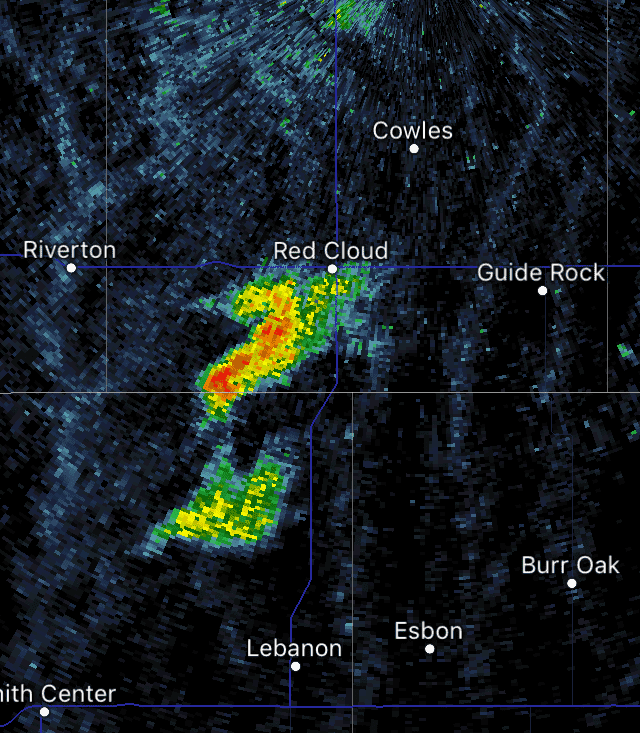
Once reaching Belleville, Kansas we paused for a moment and assessed our situation. A Tornado warned cell was located well to our south between Great Bend and Ellsworth. Meanwhile two healthy looking updrafts were maturing directly to our south in the Minneapolis and Beloit region. Finally, two cells were located along and just north of the Nebraska border near Red Cloud and directly along the dry line. While the cells to our south were more mature and exhibiting supercellular characteristics their impending merger with each other and the cluster of cells near Ellsworth discouraged us from chasing them. The cell along the NE/KS border intrigued us the most because it was remaining discrete and had unimpeded inflow from the south, both harbingers of supercell development. Heading north out of Belleville, we crossed the border into Nebraska and headed west on Highway 8. Here we got our first look at our target storm, while not too impressive visually, it had good tilting and a solid rain free base already. Passing through Superior, we continued west toward Guide Rock. Here we approached directly under the updraft of the storm. No rotation was noted at this time. Once we reached the north side of Guide Rock we encountered some precipitation as a growing cell to the SW was merging with our updraft. At this point we turned around and started to head back toward Superior, preparing to stair-step north and east with the storm.
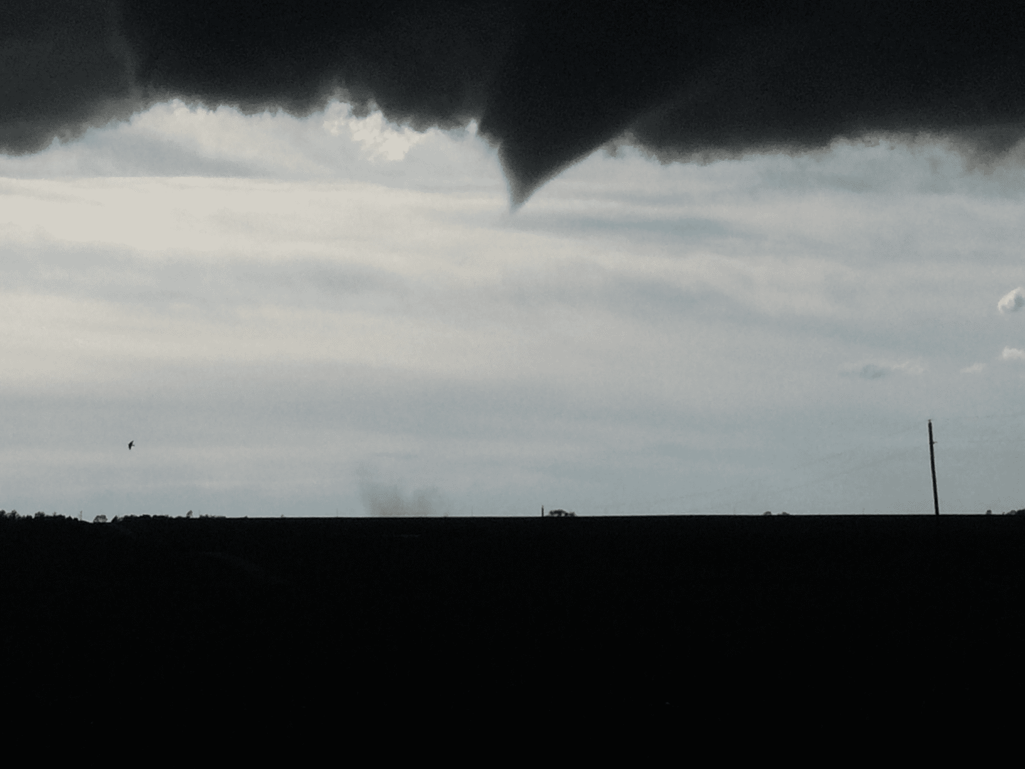
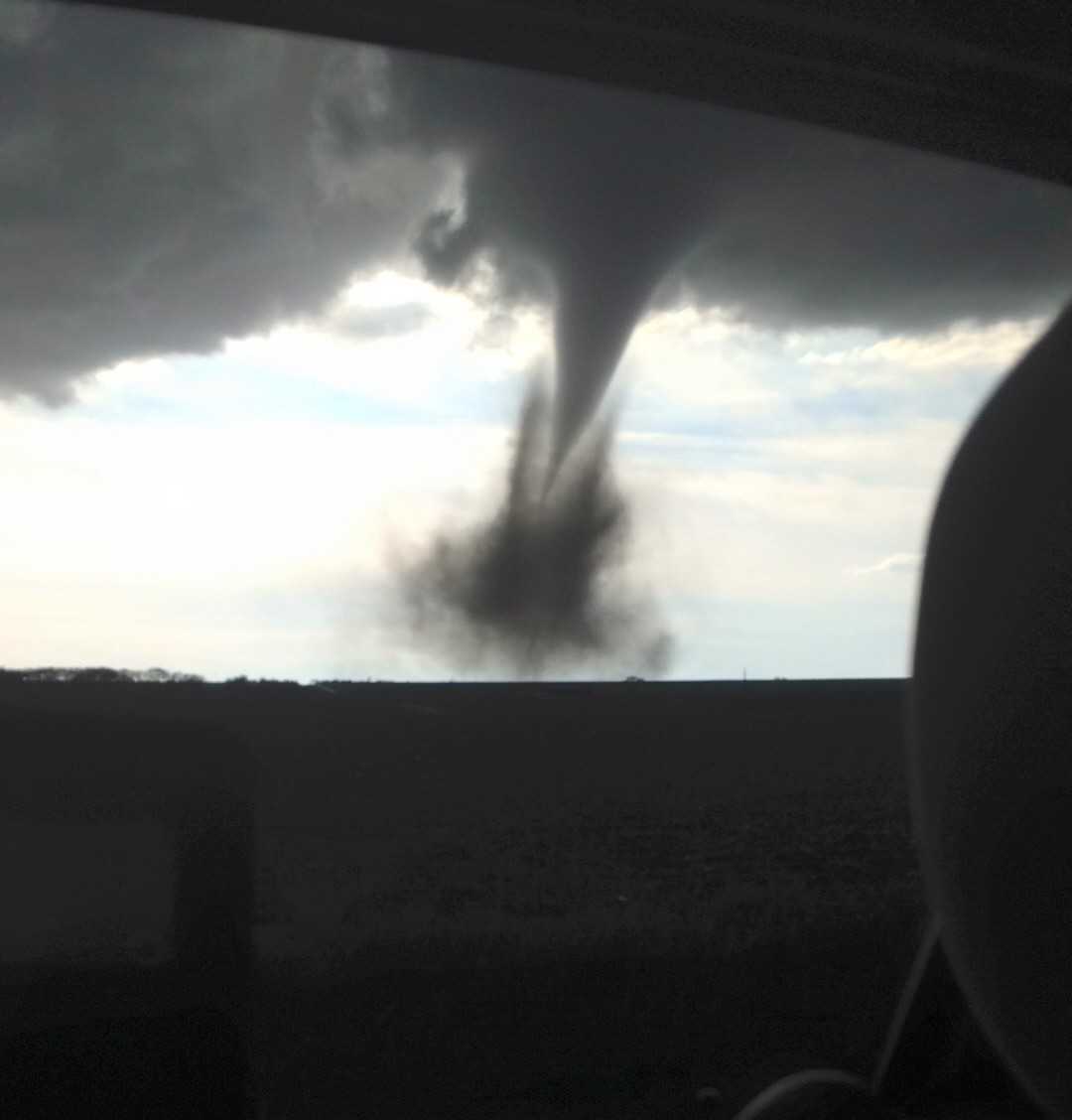
Three quarters of the way back to Superior, we pulled over at the intersection of State Highway 136 and Rd 3300(5 miles NW of Superior). There was a high vantage point here that allowed us to snap some pictures of the incoming supercell and collect our thoughts. As pickup trucks raced by, we began to notice slight rotation within the updraft. Soon enough that rotation became focused along 136 N of Guide Rock, and a lowering began to form. The rotating wall cloud tightened and a beaver tail was notable. Still the base of the clouds was relatively high and no tornado was possible yet. A brief funnel formed and reached about 25% of the way to the ground but no there was no confirmation of a touchdown. We repositioned ourselves on the south side of the intersection as the wall cloud cycled and attempted tornadogenesis for the second time. As we filmed to the WNW, just after 6:00 PM, about 2 to 3 miles away, a funnel reached down and a debris cloud was visible at the surface. TORNADO!!! The closest and clearest view I had ever of a tornado.
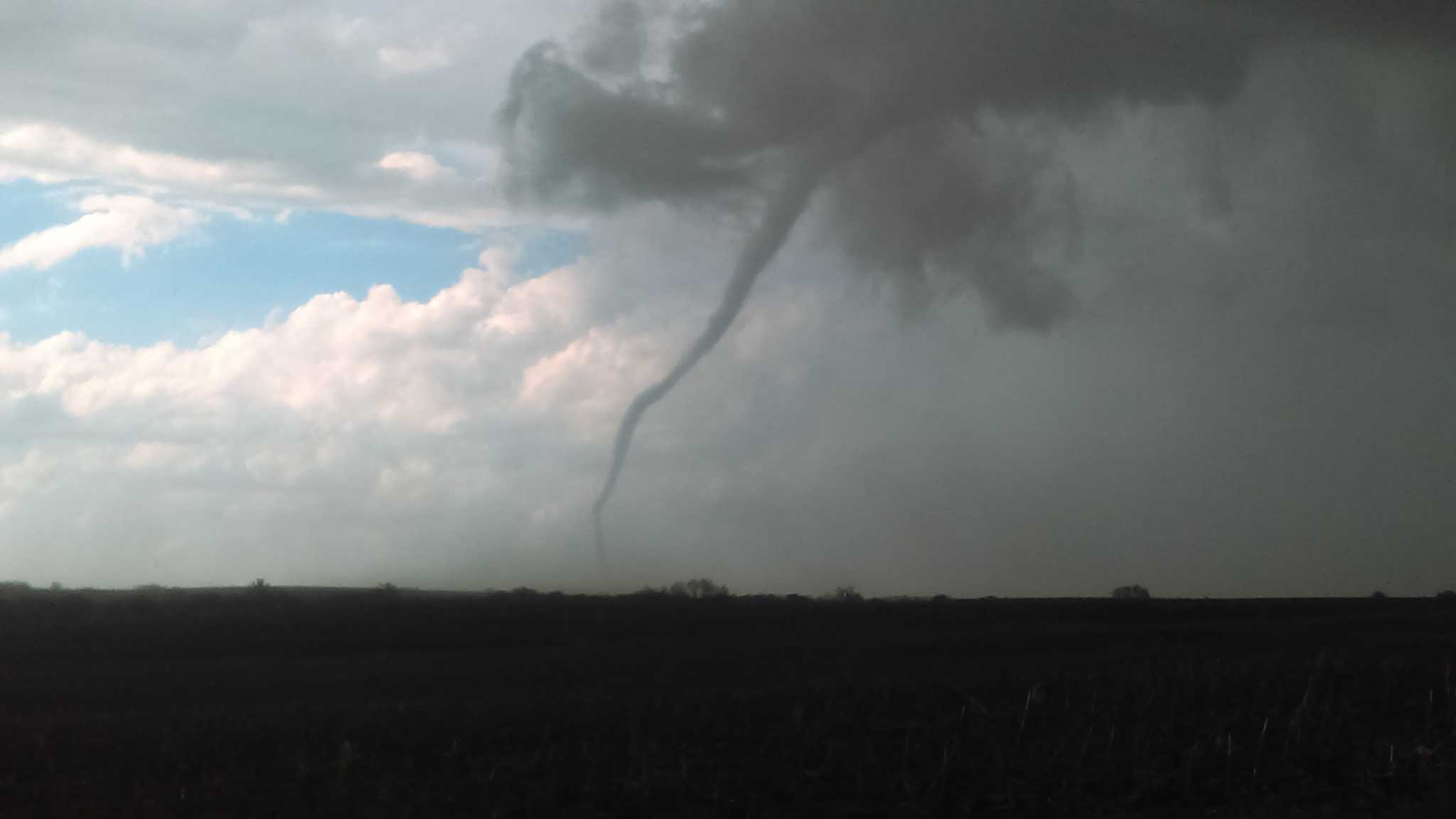
As we continued filming, the dust circulation at the surface became quite large and was lofted into the air. At the same time, the condensation funnel slowly inched its way to the surface. The difference between condensation funnel and actual funnel of the tornado was clearly evident at this time. Soon the condensation funnel snaked its way to the ground as the tornado passed over a less dirty (for lack of a better term) area.
At this point, hail began pelting us from the RFD (rear flank downdraft), and Chris quickly retreated back into the car. We also began to notice a concerning trend of movement with the tornado. It was now moving directly at us and slowing closing in on us. Due to this and the constant rain and hail, a decision was made to head south and west to reposition. Unfortunately, this meant heading into dirt road country, something that would require all 155(!) HP in my Chevy Cobalt. 2 miles south and few hundred feet west we found a suitable location to continue filming (it even included a cow!) and we were able to capture the rope out stage of this tornado (over our previously parked location).
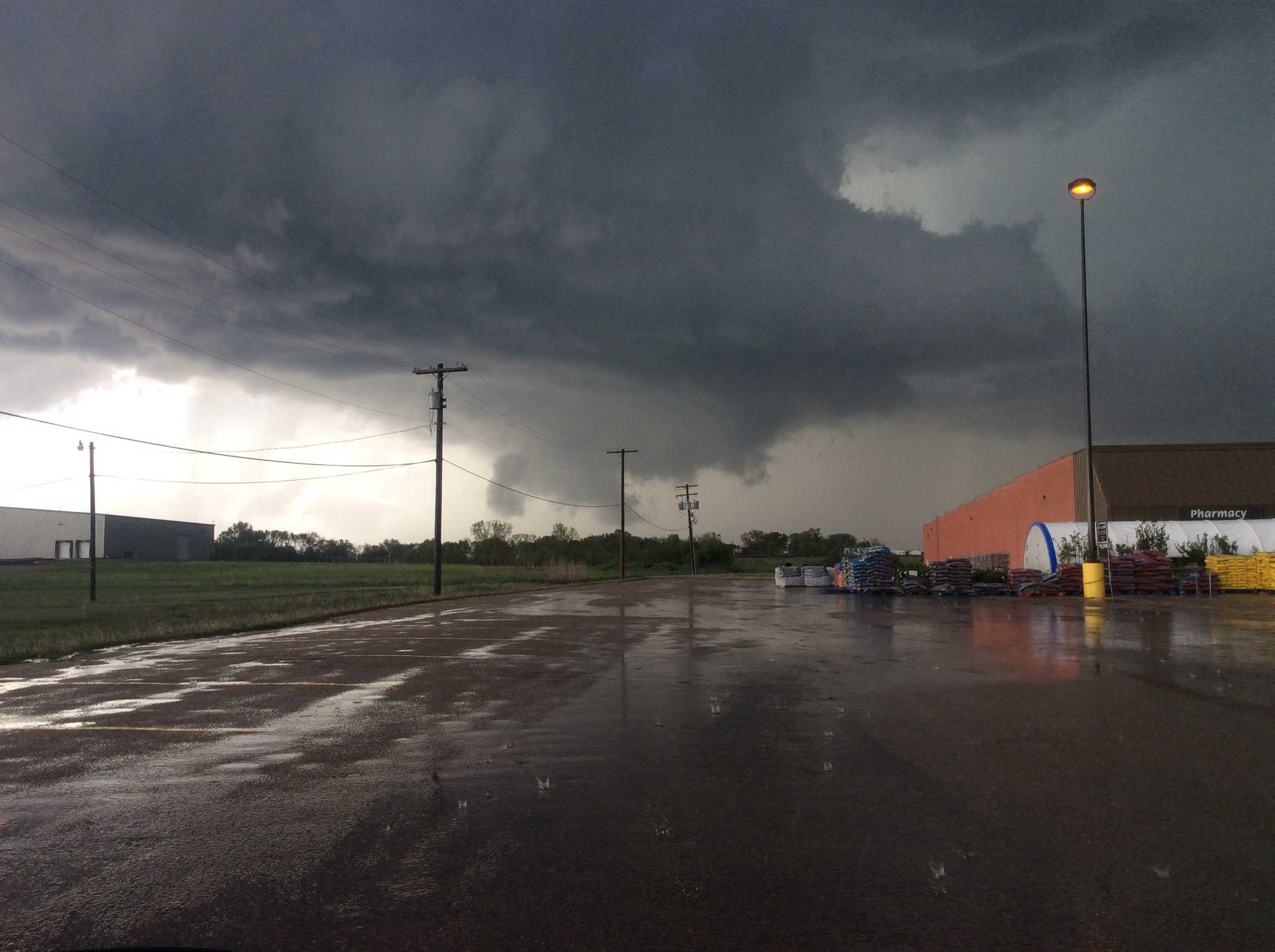
Noticing some ominous rotation clouds almost overhead, we booked it toward the east, trying to reach a paved road. Unfortunately, this require some travel over less than stable dirt roads west of Superior. Finally making back into town, we drove eastward, stopped at a Shopko parking lot, and watched the storm attempt to drop down one more tornado before the inflow from the south was choked out. With this storm clustering up, we drove south and then east attempting to catch up with a tornado warned storm near Belleville. The main circulation was rain wrapped and a brief funnel was noted on a high based flanking line along the back side of the cell. As the sun began to set and the storms quickly linearizing. We decided to call it a chase and start the long drive back to Madison. Along the way we got some beautiful images of the sunset and rainbows.
